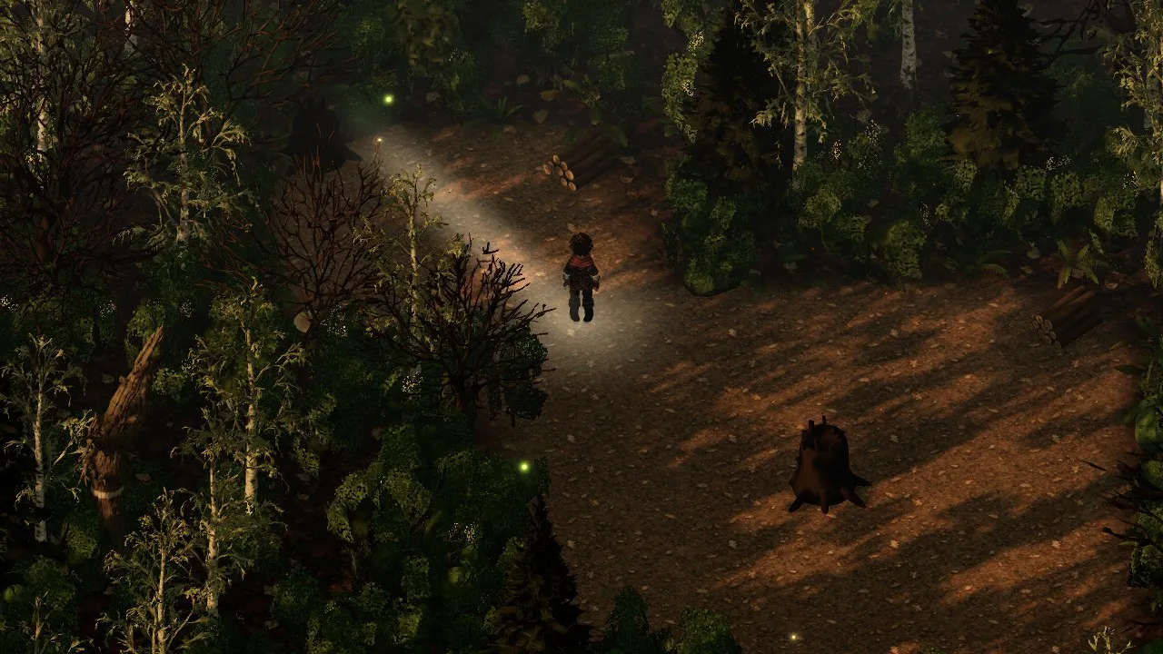
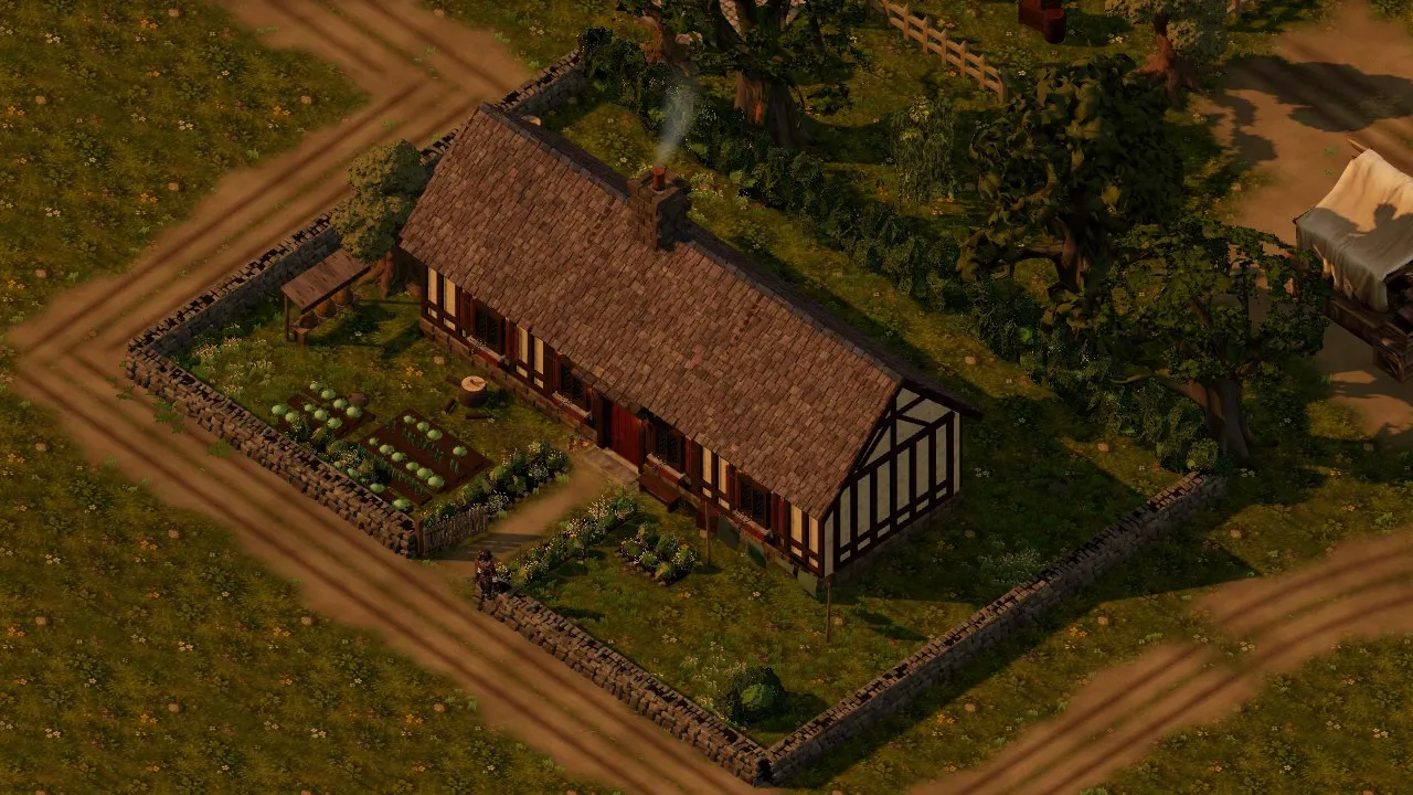
In five days I laid Brackenmere's village out three times: stretched over my hand-drawn map at 40 metres a cell, pulled in tight when the walks felt endless, then traced properly at 28 metres. The lesson was that a stylised map is a set of relationships, not a blueprint.
On 2 October I found that my first map of Brackenmere disagreed with the lore. Rather than rewrite the lore, I told the agents: "The map I gave was just a first iteration that I liked, but if it disagrees with the lore, let's work on creating a map that agrees with the lore... I'm happy to redesign the map myself."
The next morning I dropped the new one in: "I have got a new map idea... I'd like to get the map and layout etc all working." It was a painted, storybook picture: the square and its well in the middle, Market Row running east, South Lane winding down past the hero's home to the mere, the chapel on its rise and the keep on its crag.
Over the next five days the agents and I built that village three times, each a reasonable reading of the same picture. I only found out which was right by walking them.
The map I redrew on 3 October.
Where it started
Before the relayout, the village was a tight cluster in an empty field: a square, a practice yard of training monsters, a few stalls. A test bed, not a place.
Before 4 October, with the practice yards on the left. The same camera is used for every overhead below.
Version one: the map at 40 metres a cell
The first job was scale: how many metres is a cell of the map's grid? Too big and places would stand far apart "with nothing between", as the spec put it. I settled on 40 metres on 4 October.
Under the hood
The lore had suggested a village about 600 m across. At that scale places would have stood 150 to 250 m apart; at 40 m a cell the home was about 100 m from the square.
The agents built it in five pieces overnight. The most useful change was invisible: the tests stopped using coordinates and started standing at named places, so the village could move without breaking them.
After 4 to 5 October: lanes run out across a 400 m valley to farms, fields and the chapel.
Version two: pulled in tight
On 6 October I put the map next to the game and saw what was missing. "There is always something going on, fences, curves, paths, gates etc, there isn't just 'nothingness' that a user could walk around." I had gone off the wagon ruts laid along every route: "routes should be more defined by edges of things (like walls, houses, hedges, trees, bushes etc), and all those could have gaps in etc to explore."
A second session trialling ground textures found the replacement for the ruts when I asked: "Can we work on just using ground textures to denote the track, like rough worn away muddy sections".
That evening I walked a frozen preview. As the spec records my notes, the square, stalls and home were "still a little spread out", and everything else "much too far away". This time the agents measured first, timing the hero's walk to each everyday place. After the compaction the walk home was about 40% shorter.
Under the hood
The walks run in stepped game time, so they give the same answer on any machine. Market: 19.9 s before against a 12 s target, 11.15 s after. Home: 32.3 s over 122.7 m against 20 s, then 19.4 s over 73.8 m.
The practice yard and its monsters went. The edges became hedges, fences, broken walls and clumps of trees.
After 6 October: everything crowds in round the square.
Shorter, but still not right, and I wanted to know why rather than chase another art score.
What had gone wrong
On 8 October I started a fresh session and described the map as if I were walking through it:
"Notice there is hardly any open ground that the user just walks on. Everything is contained within fences or other bits like that, or hedges... Every time I'm walking somewhere, visually looking at this map, I'm coming up to something. There's something on my left, something on my right. There might be bushes, trees. There's some steps."
And the rule I cared about most: "Basically the whole of Brackenmere is something's happening everywhere. There's always a reason. It could be a bit of farmland. It could be a sparring green. It could just be where we're growing crops."
The agents measured the village against the map, and the answer was embarrassing: the scale was mixed. Cramped middle, empty edge.
My reply changed how we read the map: "that stylised map is not to scale. The houses will probably be smaller than they are shown on the map... However, the boundary lines are probably roughly right... It's more if you took the centre of everything. That's roughly where it should probably roughly be, give or take." I had treated it as a blueprint when it is a set of relationships.
Under the hood
The outer ring sat at 40 m a cell while the core had been squeezed to 13 to 25 m, and the home was 80 m off the map. Of 538 trees, almost all stood in the rim woods, in only two species.
Version three: traced as data
The third layout was traced, not placed: ways as lines, plots as shapes with a use and an edge, waters, woods, relief and each building's centre, at one smaller scale everywhere.
I asked what else would help: "is there any other meshy items we need to help with making this town realistic and interesting to walk around? I'm wondering about random house little touches". The agents came back with sixteen. "All 16 models yes, spend cap is enough."
Walking anywhere, there is now something on either side: a fenced croft, a kitchen garden, an orchard, a churchyard wall, a bank of trees. Even the sparring came back, as a reason rather than a test bed: pells and a quintain on the green.
Under the hood
28 m a cell makes the frame 280 m square and cut the streamed area from 196 chunks to 110. The apple, yew and birch cost 90 Meshy credits; the sixteen touches 480.
Through the afternoon I sent pictures as I spotted things. The vegetable patches were "very angular in their edges... quite jarring against the kind of more organic feel we're going for here." The grass tufts along one path were "so uniform it looks man-made." Offered choices for the keep, I picked: "Definitely. A lower hill, much wider hill, a larger castle which sits atop the larger wider hill." Each became a small piece: soft soil edges, tufts in clumps, a wider hill with a castle on it.
After 8 October, with the punch fixes of the 9th.
The same spot, looking east. Top left: before. Top right: 4 October, a long empty lane. Bottom left: 6 October, the stalls pulled in. Bottom right: 8 October, a street with something on both sides.
Walking it again
Early that evening I asked for "a branch and freeze right now so I can take a look and have a quick wander". I walked it on High, in rain and overcast, and sent back a punch list of pictures. "This junction is weird." "All path junctions look a bit wrong." "I can walk kind of through some of this tree. It all looks a bit weird." "This fence layout is just wrong." Of the churchyard: "It just looks way too uniform here. Nothing should be harsh lined."
The next morning I walked it again: "This mound is a perfect dome." "The bridge is wrong, the river needs to thin so it goes under the arch."
These were finishing problems, not layout problems, which was the point. Both lists were merged by that afternoon.
Under the hood
The worst streaming update on the measured walk was 5.8 ms on High, against an 8 ms limit.
Looking south-east past the bakery, in the same order: trees, then the chapel far off, nearer, and finally on its rise behind fences and gardens.
What I took from it
Three layouts in five days sounds like waste. Not quite: named places in the tests meant each move cost a layout, not a rewrite, and timed walks turned "too far" into numbers.
But the walking found what the agents could not. I would change the order now: agree what the picture actually fixes, trace it as data, look at the plan, build one corner, and walk it.
That evening my kids had a go. "They loved it", I wrote afterwards, but "they got a bit lost, didn't know how to get places", and I asked for "more obvious signage as well to what leads where". Fingerposts went up at the main junctions that night.
At the start of October I painted a new map of Brackenmere: the square and its well in the middle, Market Row running east, South Lane winding down past the hero's home to the lake, the chapel on its rise and the castle on its crag. Over the next five days the AI helpers and I built that village three times. Each was a fair reading of the same picture. I only found out which one was right by walking round them.
The map I painted on 3 October.
Where it started
Before this, the village was a tight little cluster in an empty field: a square, a yard of practice monsters and a few stalls. Somewhere to test things, not a real place.
Before. All the views from above in this post are from the same spot.
Version one: spread out
The first question was how big each square on my map should be in the game. We picked a size and the helpers built it overnight. Lanes now ran out across a wide valley to farms, fields and the chapel.
Version one: a big, open valley.
Version two: pulled in tight
When I put the game next to my map, something was missing. On my map there's always something going on: fences, curves, paths, gates. There isn't just empty ground to walk across. And the walks felt endless.
So the helpers timed the walks to everyday places and pulled everything in. The walk home got about 40% shorter, and the paths got edges: hedges, fences, broken walls and trees.
Version two: everything crowded round the square.
Shorter, but still not right.
What had gone wrong
So I described the map as if I was walking through it: "Every time I'm walking somewhere... I'm coming up to something. There's something on my left, something on my right." And the rule I cared about most: "The whole of Brackenmere is something's happening everywhere. There's always a reason."
When the helpers measured the village against my map, the answer was a bit embarrassing. The middle had been squashed, but the edges were still spread out. Cramped in the middle, empty round the outside.
That's when I realised my map isn't to scale. The houses are drawn bigger than they'd really be. What matters is where things sit in relation to each other. I'd been treating a storybook picture like an architect's plan.
Version three: traced properly
The third time, the helpers carefully traced the map: every path, every plot of land and what it's for, the water, the woods, the hills, and where each building sits. Then they built it at one size everywhere.
I asked what else would make it feel real to walk around, and they suggested sixteen little touches for the houses and gardens. I said yes to all of them. Now, wherever you walk, there's something either side: a fenced cottage garden, a vegetable patch, an orchard, a churchyard wall, a bank of trees. Even the sword practice came back, as a proper practice green this time.
I kept sending pictures of things that looked off: vegetable patches with hard edges, grass tufts in a perfect line. Each was softened, and the castle now sits on a wider, gentler hill.
Version three: traced from the map.
The same spot, looking east, all four times. Top left: before. Top right: a long empty lane. Bottom left: the stalls pulled in. Bottom right: a street with something on both sides.
Walking it again
That evening and the next morning I walked round it and sent back long lists of pictures: odd junctions, a tree I could walk through, fences that didn't join, a mound shaped like a perfect dome.
These were finishing touches, not layout problems, and that was the point. The layout was finally right. Both lists were fixed by the next afternoon.
Looking past the bakery, in the same order: trees, then the chapel far off, then nearer, and finally on its rise behind fences and gardens.
What I learned
Walking around found what the helpers couldn't. Next time I'd agree first what the picture really means, trace it, build one corner and walk it.
That evening my kids had a go. They loved it, but they got a bit lost. So signposts went up at the main crossroads that night.
The Charwood, a charcoal burners' wood that is generated fresh for each visit, was built in an afternoon on 13 October and rebuilt that evening because it felt like the hedge maze in different clothes. The fix was a new layout, not more decoration, and playing it changed it twice more.
In two days a hovel became a house that grows a room at a time, with builders, wear and repair. Along the way I stopped the agents chasing an art score: fix what is broken, and no 8 of 10 bar.
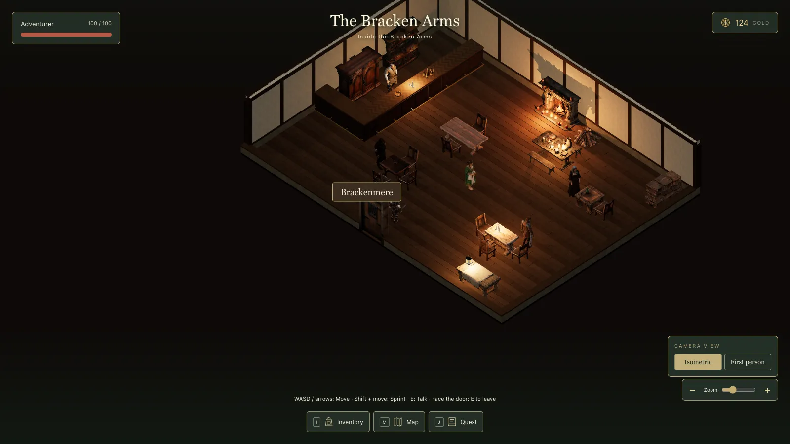
On a Wednesday evening I asked to open a village door and step inside. By bedtime the inn, the forge and the apothecary were rooms bigger than their houses, furnished with my own Meshy models and staffed by eight people you could talk to.
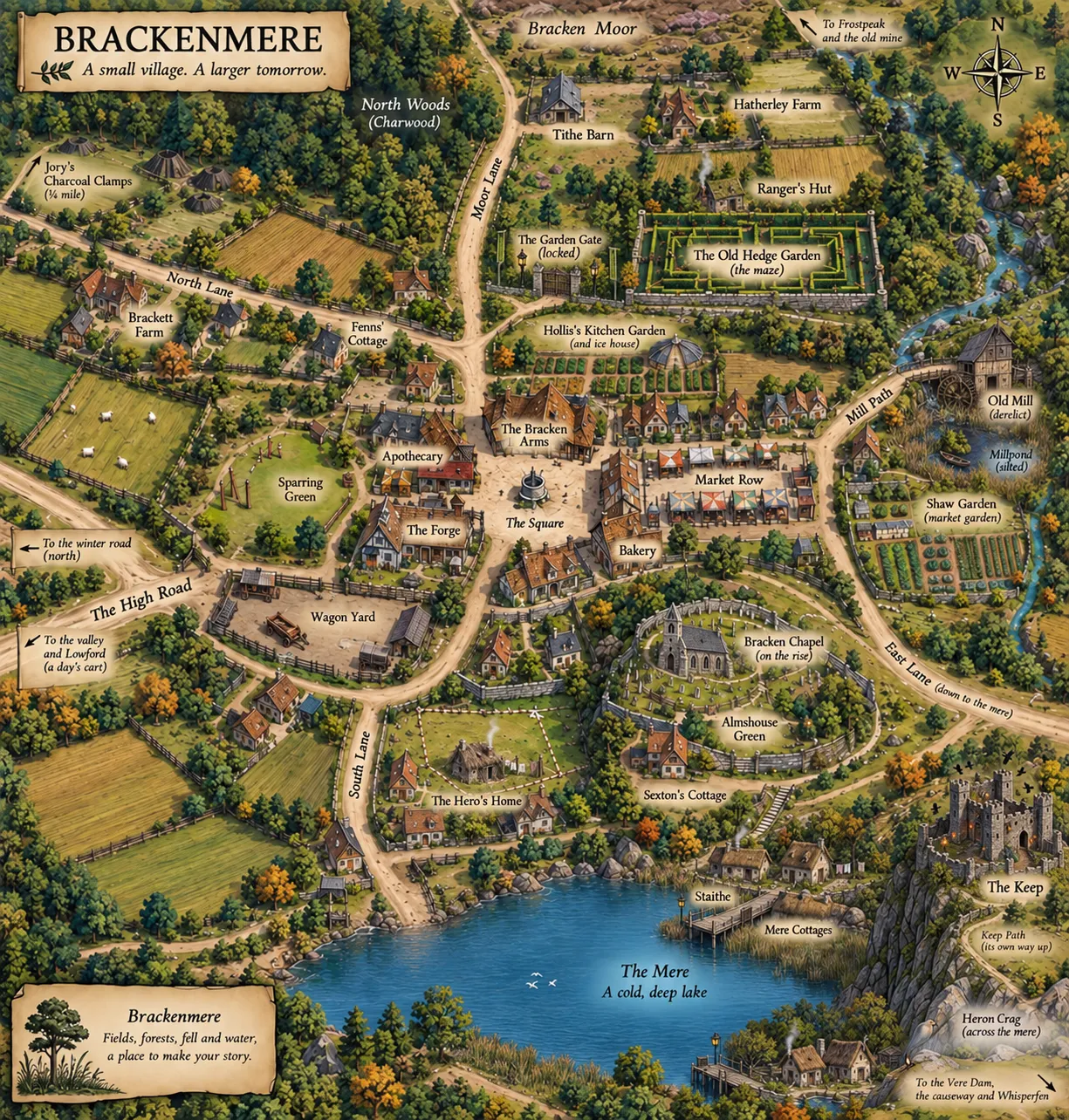 The map I redrew on 3 October.
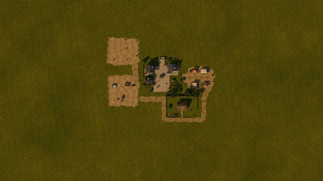 Before 4 October, with the practice yards on the left. The same camera is used for every overhead below.
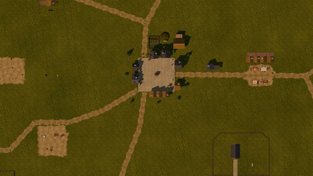 After 4 to 5 October: lanes run out across a 400 m valley to farms, fields and the chapel.
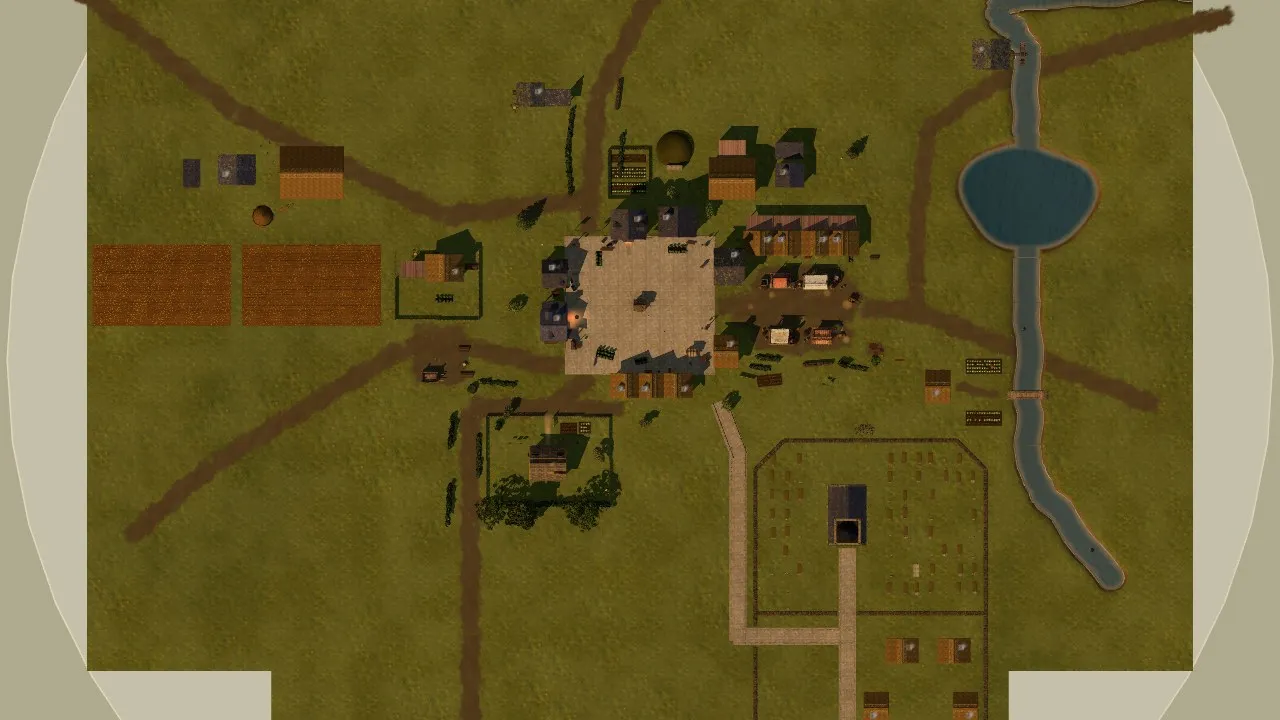 After 6 October: everything crowds in round the square.
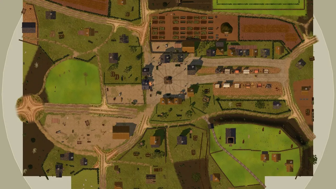 After 8 October, with the punch fixes of the 9th.
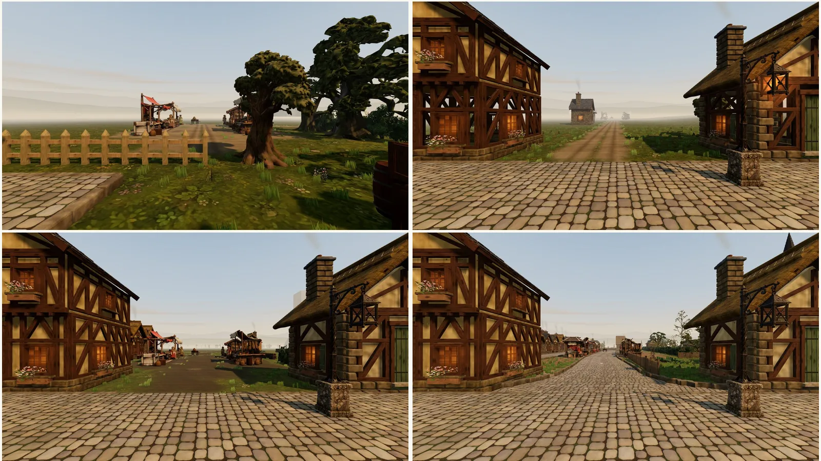 The same spot, looking east. Top left: before. Top right: 4 October, a long empty lane. Bottom left: 6 October, the stalls pulled in. Bottom right: 8 October, a street with something on both sides.
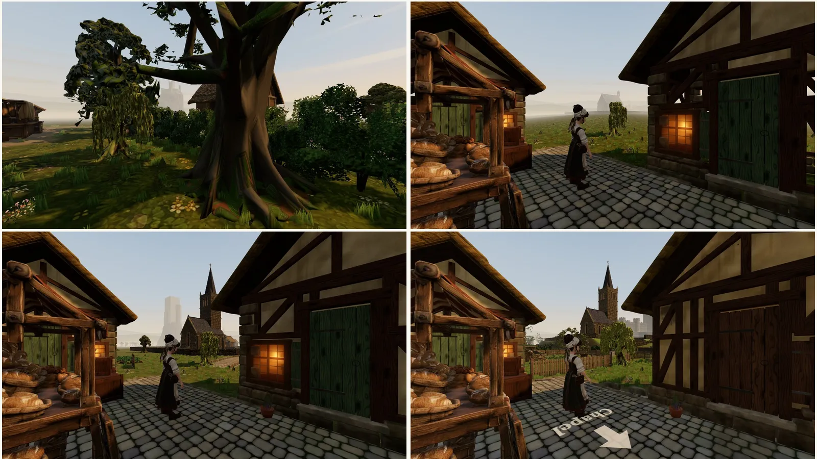 Looking south-east past the bakery, in the same order: trees, then the chapel far off, nearer, and finally on its rise behind fences and gardens.